Maps & Elevation Profiles
About This Information
This information was gathered by volunteers from the Appalachian Trail Conservancy and the Georgia Appalachian Trail Club over a number of years.
This is an ongoing process as our volunteers refine data on trail features and as portions of the trail are relocated. We make every effort to update the data in a timely fashion but there is always the possibility of errors or omissions. GATC suggests that hikers planning trips on the Appalachian Trail use the guidebooks and maps produced by the Appalachian Trail Conservancy.
For information about access to the A.T. from U.S. Forest Service roads, consult the Chattahoochee-Oconee National Forest Map available from USFS and outdoor stores as well as a PDF version on the internet.
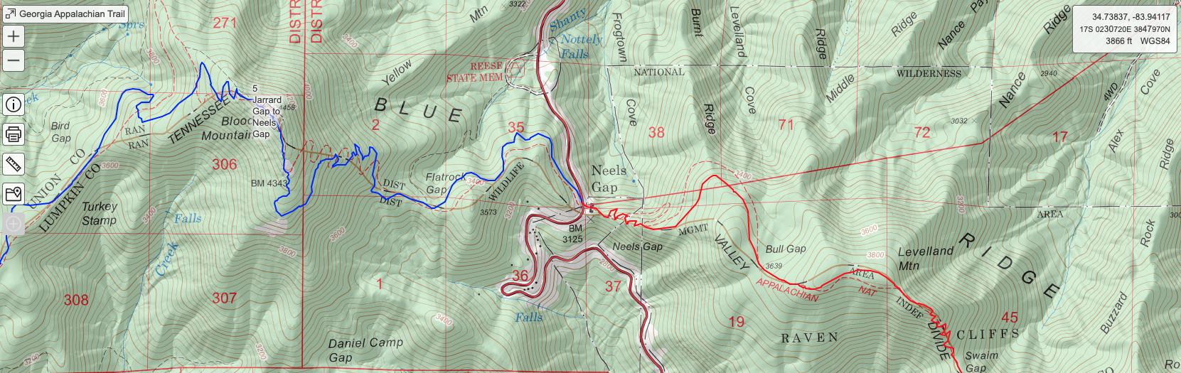
Georgia Appalachian Trail Map
This map in PDF format is intended to show the general location of the A.T. in Georgia and mileages between access points and shelters. It is useful for visitors to orient themselves to the A.T. as it winds through Georgia and it can be used to plan a hike.
View Map
A map with more detail is an important resource for hikers to have with them when they are out on the trail. To view and print more detailed maps, see the profile maps and interactive map below.

Georgia Appalachian Trail Profiles
These pages are also in PDF format and are intended to provide a representation of the trail elevation changes in Georgia in diagram format. The profiles include the A.T. in Georgia, the Approach Trail and the Hike Inn Trail, which parallels the Approach Trail.
View Elevations
Interactive Map for Georgia Appalachian Trail
This interactive map of the Georgia A.T. is hosted on the CalTopo website. On the left of the screen are features that can be displayed. The page opens with all of the features expanded. The first thing you should do is click on “Geo” beneath the Appalachian Trail section to collapse it and repeat for others. The check marks determine whether the feature is displayed. You can expand any of these to select or deselect individual features. In the upper right hand corner, there is a selector for the map displayed in the background.
The USGS 7.5’ and the USFS layers are best. The secondary layer “Normal” provides the Shaded Relief for the 3D effect. At the upper left is a zoom control. The Config tab allows control of the map display. Data can be exported in GPX and KML format for use with other programs such as Google Earth. The Print tab allows creation of a PDF of pages you define by positioning rectangles on the map. The CalTopo tab provides documentation. In addition there are numerous YouTube videos about using CalTopo.
View Map
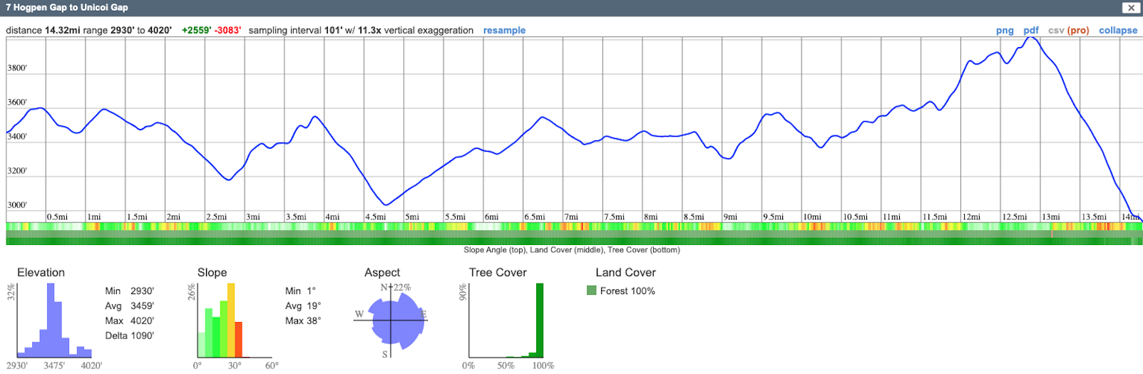
If you click on a trail, you can select one of several options. Terrain Statistics createTrail Elevations a profile and other statistics about the trail. Beneath the profile are three bands showing slope angle, land cover, and tree cover. It is possible to save this as PNG or PDF. This profile is made by CalTopo using a grid of elevation points instead of the elevation from the GPS data. The elevation values will usually be a little understated at peaks, but the general shape is correct and a good guide to elevation gain and loss.
Georgia 4000 Challenge
Learn MoreOverview Map
This 11″ x 17″ map shows the 32 summits in the Georgia 4000 Challenge and their location relative to each other, towns, and major highways. The interactive map below can be used to explore the nearest access roads and trails.
View Map
Interactive Map
This is a map for the Georgia 4000 Challenge, described elsewhere on this website. Like the A.T. map above, this map is hosted on CalTopo and the general directions above apply. You can click on one of the peaks in the list to zoom to it, adjust the zoom level to your liking and create a PDF of the map.
View Map